Your phone can still be a practical safety tool when networks fail. Many apps keep preloaded guides, checklists, maps, and tools that run without service. Spend about 15 minutes now to set up what matters.
Add Medical ID and one ICE contact so first responders see critical medical information without unlocking the device. On iPhone use Health > Medical ID; on Android go to Settings > User & Accounts > Emergency Information.
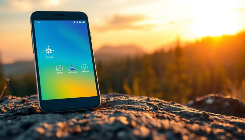
Download maps, save PDF guides, and test an app that offers offline navigation or checklists. Your phone’s GPS, compass, and sensors still work, and preloaded routes can guide you when the world goes dark.
Plan for power. Keep a charging strategy, like a solar generator or extra battery, to stay powered through multi‑day outages. Show family where these tools live on the phone and rehearse quick access from the lock screen.
This short list helps you prioritize what to install, what to open first without service, and where to store vital information so one device reduces friction when minutes matter.
Why Offline Matters When Cell Service Fails in U.S. Emergencies
When storms or outages strike, cellular networks can drop fast, so your device must work without relying on live service.
In many U.S. incidents, towers get damaged or networks become overloaded. Relying only on cell service can stall critical actions when every second counts.
Preloaded maps, first‑aid protocols, shelter locations, and saved contacts remain usable on the phone even without a connection. These local files and apps let you navigate your area and follow procedures in a crisis situation.
On‑device Medical ID and ICE contacts give first responders quick access to vital information at the scene, which can speed help and reduce confusion. A corded landline may also work when wireless options fail.
Rugged devices and offline workflows used by field teams show that storing data locally cuts response time. Preparing your phone ahead of time is a practical step to reduce personal risk during a natural disaster.
Core emergency offline features to download and set up today
Make a short plan and install key tools so your phone can guide you when service is spotty. Start with one app that stores preloaded checklists and step-by-step guidance, like the American Red Cross Emergency and First Aid apps, and the FEMA app for preparedness lists and shelter locations.
Preloaded guidance and checklists that work without internet
Install an app with saved checklists so you can follow structured steps to get help and stay safe when you can’t load web pages. Test where to tap to open the checklist quickly.
Offline maps and GPS-based location tools
Download city maps and evacuation routes using tools like BackCountry Navigator or MapDroyd. GPS still gives a location on the phone, so saved maps help you find a way without data.
Signal-free communication and status check-ins
Add at least one walkie-talkie style app such as Zello or a Bluetooth mesh tool like Bridgefy to relay short messages and reassure loved ones when networks are down.
Stored medical info, ICE contacts, and first aid protocols
Add medical information to your device: use Medical ID on iPhone or Emergency Information on Android. Include conditions, allergies, meds, and an ICE contact so first responders can view critical data from the lock screen.
Local shelter maps and workflows that sync later
Save shelter locations and capture notes or photos in apps that sync when connected. Put safety apps in one labeled folder and review content quarterly so your family has the same plan and can act fast.
First aid and medical knowledge you can access without data
Store trusted guides and quick how-to lessons on your phone so you can deliver care immediately. This keeps vital first aid knowledge at your fingertips when web access is limited.
American Red Cross First Aid app
The American Red Cross First Aid app includes preloaded videos, step-by-step instructions, and interactive quizzes. These resources work without searching the web, so you can follow clear steps for wounds, burns, and breathing problems.
Hands-Only CPR guidance
The Hands-Only CPR app from the American Heart Association prompts you to call 911 and keeps the correct compression rhythm with simple graphics. It trains you in compressions and gives calm, direct guidance during high-stress moments.
Medical ID and Emergency Information
Set up Medical ID on iPhone (Health app) and Emergency Information on Android so first responders can view medical information from the lock screen. Include allergies, prescriptions, conditions, and an ICE contact to speed care decisions.
Comprehensive offline health references
Install the Merck Manual app for a self-contained medical reference on injuries, fractures, and burns. Test each app’s navigation in advance, practice quizzes in the Red Cross app, and print a minimal cheat sheet as a paper backup.
Stay connected when networks are down
A small set of communication apps can turn your phone into a local radio and locator when public networks fail.
Zello and walkie‑talkie style communication
Zello uses push‑to‑talk channels that mimic radio groups so one tap updates everyone. Create a family channel and test voice vs. text to see which saves battery and cuts confusion.
Bridgefy and Bluetooth mesh messaging
Bridgefy relays short texts via Bluetooth mesh to nearby phones without Internet or SMS. It’s ideal for local coordination when towers are saturated and you need a way to swap concise status notes.
“I’m Safe,” SirenGPS, and check‑in tools
Enable the American Red Cross “I’m Safe” check‑ins to quickly notify loved ones you are OK. SirenGPS can share your identity and precise location with dispatchers and may help them route help faster.
Pre‑add contact profiles, meeting points, and a small family channel name. Combine a brief status with a location note, label apps on your home screen, and practice calling 911 from within an app so you can get help fast.
Navigating with offline maps, GPS, and compasses
For travel through rural or unfamiliar areas, downloadable maps and a reliable compass let your phone guide you when web maps can’t load. Preload relevant state and neighborhood map tiles in at least one navigation app so the device can help find routes without data.
Downloadable maps and route planning
Save entire country maps or regional tiles with tools like MapDroyd to use GPS and compass modes anywhere in the world. Pre-plan multiple routes and store them so you can switch quickly if roads close or hazards appear.
Topo and off‑road navigation
Use BackCountry Navigator or similar topo apps for off‑road and rural evacuations. These apps support downloadable topo layers that work beyond cell coverage and show terrain details not found in standard road maps.
Grid references and battery-aware tips
GPS Grid Reference adds precision by combining USGS, OSM, and topo maps with grid coordinates useful for search teams and rescue. Mark safe zones, shelters, and water sources on your maps ahead of time to save time later.
Conserve battery by dimming the screen, using airplane mode with GPS on, and checking position periodically instead of constant tracking. Print a small paper map as a redundancy, and refresh downloads quarterly so map information stays current.
Disaster intelligence and shelter information without a signal
You can use mapped disaster intel and cached shelter lists on your phone to plan the next safe move.
FEMA app: preparedness checklists and recovery centers
The FEMA app organizes preparedness checklists, meeting points, and maps of Disaster Recovery Centers. It shows shelter details and contact info so you can pick a nearby option quickly.
Tag likely shelter sites, mark pet‑friendly locations, and save local emergency management pages to review when connectivity returns.
Global hazard mapping with Disaster Alert
Disaster Alert (Pacific Disaster Center) maps active hazards worldwide. Travelers and families use it to track cascading risks during large natural disasters and to compare hazards across regions.
Red Cross apps and cached area guidance
The American Red Cross Emergency app caches area alerts, shelter availability, and safety content for quick access. It also supports “I’m Safe” notifications and Shelter View mapping of Red Cross shelter status.
Capture photos and short notes about damage while offline and sync later with agencies or insurers. Practice switching from hazard view to picking a shelter and sharing your route with a contact so the flow becomes routine.
Travel, evacuation, and family coordination tools
When travel or evacuations begin, a few well‑chosen apps can keep your family coordinated across towns and borders.
Smart Traveler and STEP. Install the Smart Traveler app and enroll in STEP before you go. STEP registers you with the nearest U.S. Embassy or Consulate so officials have your contact information and location if the world event affects travelers.
Life360 for group tracking. Build a family circle in Life360 to share real‑time and recent location history. Use arrival/departure alerts, set key places, and agree on a simple check‑in protocol during moves.
Red Cross shelter info and city alerts. Save local shelter pages and county alert links to speed decisions when an evacuation order hits your area. Keep one folder in your app list for quick access.
Practical coordination tips: Store copies of IDs, reservations, and planned routes in a secure app for reference. Verify embassy addresses for destinations around the world before travel. Define meet‑up places both inside and outside your neighborhood to handle blocked roads.
Use in‑app messages plus an email fallback so loved ones get updates when SMS or service falters. Practice a quick roll call and a 24‑hour regroup rule if communications are lost. A minimal evacuation plan that names roles, rendezvous places, and backup transport reduces confusion and keeps your family moving safely.
Personal safety and panic tools that work offline
Panic apps put immediate help and clear location data one tap away. These tools send GPS coordinates to preset contacts or dispatch so trusted people know where to go.
Red Panic Button, Silent Beacon, and SirenGPS
Red Panic Button sends GPS coordinates via text and email to your chosen contacts. Silent Beacon also sends texts, emails, and location while showing local alerts to keep you informed.
Noonlight and silent help requests
Noonlight supports silent activation when speaking is unsafe. It transmits your location so responders can get help to you promptly.
Quick setup tips: Configure a short, standardized message plus a map link so recipients instantly see the problem and where you are. Test lock‑screen access and background permissions so alerts work when the phone is locked.
Assign a small group of contacts who know the protocol and won’t overload notifications. Pair panic tools with a simple safety plan: when to activate, how to move, and how to confirm receipt with loved ones. Conserve battery by using low‑power modes but keep critical alert functions active. Update contacts when you move or travel and run periodic drills so one press reliably starts the follow‑up sequence.
Power, hardware, and setup to keep offline features running
Think of charging, durability, and app prep as one simple system that keeps your phone working through multi‑day outages.
Solar generators and panel‑battery kits are a good idea for extended loss of grid power. A small solar unit can keep a phone and handheld radio charged during hurricane or wildfire seasons.
Carry a high‑capacity power bank and short cables, and rotate them quarterly to verify charge retention. Pick a rugged case and screen protector so a cell phone survives drops and weather.
Choose battery‑focused or rugged models if you spend time in remote areas. Preload maps, checklists, and an app with saved content so critical data works without service.
Set a low‑power profile: dim the screen, stop background refresh, and limit radios while leaving GPS on when needed. Put key tools and lock‑screen Medical ID on the first home screen to save taps and time.
Label a dedicated charging kit and stage it for quick grab. Finally, make sure to run a short monthly test: open apps offline, confirm content, and check accessory health so first responders and loved ones have the best way to help.
Make your phone a reliable lifeline before the next emergency
Prepare one device now so it holds the maps, contacts, and guides that matter most later.
Create a short checklist: install key emergency apps, download maps, add Medical ID and ICE, and put everything in a labeled home‑screen folder for quick access.
Adopt the American Red Cross and Red Cross app tools for first aid and alerts. Save a brief list of shelters and agency contacts, then email a two‑page list to yourself and a trusted contact as backup.
Enable one local communication app and one status tool, stage chargers and a solar or power bank kit, and print a simple map with two meet‑up places. Run a quick drill: open each app without data, confirm location sharing, and practice the plan with your family so responders can help faster when it matters.