Your smartphone packs powerful navigation tools right in your pocket. Built-in sensors like magnetometers and gyroscopes work together to create a reliable directional guide, even when cellular signals fade. This feature transforms your device into a modern navigation aid that functions anywhere—no Wi-Fi or mobile data required.
Many phones come with a pre-installed app that displays real-time directional data. These tools use Earth’s magnetic field to pinpoint north, south, east, and west. Outdoor enthusiasts and professionals alike benefit from the precision of these systems, which often include elevation tracking and coordinate mapping.
Whether hiking remote trails or navigating urban landscapes, your device’s built-in capabilities ensure you stay oriented. Third-party apps can enhance functionality, but the core technology works independently. Calibration is simple—just follow your phone’s prompts for optimal accuracy.
This guide explores how to activate and maximize your phone’s hidden navigation potential. From basic setup to advanced features, you’ll learn to trust your device as a versatile tool for any adventure or work scenario.
Getting Started with Your Compass App
Modern smartphones transform into reliable navigation tools through built-in hardware and intuitive software. To begin, ensure your device meets the app’s requirements—some tools require iOS 15 or newer for full functionality. This foundational step guarantees seamless integration with your phone’s sensors.
Installation and Initial Setup
Download your chosen tool from a trusted developer’s website or app store. During installation, grant access to location services and motion sensors—these permissions allow the app to combine GPS, gyroscope, and magnetic data. Many apps guide users through calibration steps to refine accuracy before first use.
Understanding the User Interface
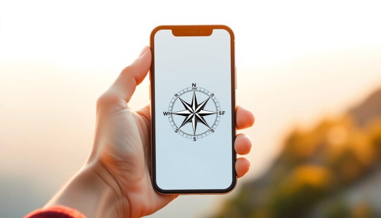
The screen displays cardinal directions in bold letters alongside degree markers. A rotating dial mimics traditional compass behavior, while coordinates update in real time. Customize display colors or themes through settings to improve visibility in sunlight or low-light conditions.
For troubleshooting, contact the developer directly via mobile@netigen.eu. Most apps let you save frequent destinations as favorites, streamlining navigation for repeat journeys. Regular updates ensure compatibility with evolving operating systems and hardware improvements.
Using a digital compass without internet for Offline Navigation
Modern navigation doesn’t rely on cellular signals to keep you on track. Built-in sensor utilities enable precise direction finding even in areas with zero connectivity. This capability transforms your device into a standalone guide for wilderness treks or urban exploration.
How Offline Navigation Works
Your phone’s magnetometer and gyroscope collaborate to interpret Earth’s magnetic field. These components generate real-time orientation data without external networks. Altitude tracking and coordinate logging function continuously, unaffected by signal strength.
Benefits for Travelers and Outdoor Enthusiasts
Hikers and campers gain reliable orientation in remote valleys or dense forests. The system conserves battery life by eliminating background data transfers. Professionals pair these features with preloaded topographic maps for complex route planning.
Adventure apps store critical waypoints locally, ensuring access to saved locations. This approach prevents unexpected signal loss from derailing expeditions. Whether navigating city alleys or mountain trails, your device remains a trustworthy ally.
Exploring Advanced Features and Tools
Modern devices now incorporate professional-grade tools once reserved for specialized equipment. These enhancements transform your phone into a multifunctional navigation station, combining precision tracking with environmental insights.
Real GPS and Magnetic Sensor Readings
High-end utilities analyze 16 cardinal points using dual satellite networks. Your position appears as latitude/longitude coordinates updated every half-second. Magnetic sensors cross-reference this data with local field measurements for unmatched reliability.
MGRS Coordinates and Azimuth Functionality
Military Grid Reference System (MGRS) support enables land navigation for survey teams and first responders. The azimuth tool calculates bearing angles within 0.5-degree accuracy. Combined with barometric altitude readings, these features support complex route planning.
Weather and Lunar Cycle Integration
Live weather overlays show precipitation patterns and air quality indexes. Moon phase tracking aids photographers planning night shoots and farmers timing crop cycles. These environmental metrics help users make informed decisions about outdoor activities.
Professional navigation apps store critical data locally for offline access. Elevation profiles update automatically during mountain ascents, while saved waypoints create reusable expedition templates. This combination of technical capabilities makes modern mobile tools indispensable for field work.
Privacy and Data Collection Insights
Navigation apps require careful evaluation of how they handle sensitive information. Developers like Hopebest Inc Limited and ZipoApps outline distinct approaches in their privacy policies, impacting how your movements and preferences get recorded.
Understanding Developer Privacy Practices
Privacy practices may vary significantly between applications. Some tools collect location history to improve compass accuracy, while others track identifiers across unrelated platforms. Always review whether data gets linked to your account or remains anonymous.
Age restrictions and regional laws often influence what developers can collect. For instance, ZipoApps’ policy shows they gather purchase records alongside diagnostic reports. This combination helps refine features but requires clear user consent.
Data, Identifiers, and Usage Diagnostics
The following data may appear in reports: device identifiers, session durations, and crash logs. Hopebest Inc Limited uses this information to fix technical issues without tying it to personal profiles. However, cross-app tracking remains possible through shared advertising networks.
Location details serve functional purposes but carry privacy risks. Check how long companies retain GPS coordinates and whether third parties access this data. Most app support privacy settings let you disable non-essential tracking while maintaining core navigation features.
Regularly audit permissions through your phone’s settings menu. This practice ensures your chosen tool aligns with both legal standards and personal comfort levels regarding data exposure.
Leveraging the App for Professional and Recreational Use
This navigation tool adapts to both work demands and adventure needs through smart customization. Users gain precision tools for specialized tasks while maintaining simplicity for casual exploration.
Customizable Compass Views and Themes
Adjust color schemes and layouts to match your environment or preferences. Dark themes improve visibility during night hikes, while high-contrast modes work best in bright sunlight. Save multiple profiles for quick switching between mountain treks and urban navigation.
The simplified view strips away complex data for fast directional checks. Recreational users enjoy seasonal backgrounds that blend functionality with visual appeal. These utilities ensure the interface remains clear without sacrificing personality.
Integrated Features for Field Professionals
Surveyors and emergency teams rely on Military Grid Reference System (MGRS) coordinates for exact location sharing. Real-time altitude tracking aids geologists studying terrain changes. Archaeologists document sites using azimuth bearings accurate to half a degree.
Weather integration helps construction crews plan around storms, while lunar phase tracking assists photographers. Visit the developer website for app support tutorials on combining these tools. Field games and training exercises benefit from waypoint challenges using magnetic sensor data.
Whether mapping a city park or coordinating rescue operations, these features transform your device into a versatile professional instrument. Regular updates from the website app ensure compatibility with evolving industry standards.
Seamless Integration with Your Smartphone
Your phone’s navigation features become truly powerful when fully synchronized with its operating system. Proper calibration ensures sensors work in harmony, delivering precise directional data across iOS, Android, and other platforms. This alignment maximizes hardware capabilities while maintaining smooth performance.
Optimizing Settings for iOS and Other Platforms
Adjust permissions to let your app access motion sensors and location services. For iOS devices, ensure your software requires iOS 14 or newer for full functionality. Android users should enable high-accuracy mode in device settings.
Battery management is critical for extended offline use. Reduce screen brightness and disable unnecessary background processes. Many tools offer power-saving modes that prioritize navigation features over other tasks.
Customize notification preferences to minimize interruptions during hikes or fieldwork. Background refresh settings impact how often your app updates location data. Check your developer’s website for platform-specific optimization guides.
Sync with mapping software and weather services through your phone’s sharing features. This integration provides layered navigation data without draining resources. Regular updates from the support team ensure compatibility with new OS versions.
Calibrate sensors monthly using your phone’s built-in tools. This simple step maintains accuracy as hardware ages. Whether your device requires iOS 15 or runs the latest Android build, these practices keep your navigation system reliable.
User Reviews and Real-World Experiences
Real-world feedback highlights how navigation tools meet diverse needs beyond technical specifications. Users consistently praise the app’s accuracy in workplace scenarios and outdoor adventures, with one reviewer noting its effectiveness in redirecting coworkers during highway navigation.
Customer Feedback and Testimonials
FROG@ reported using the tool to guide colleagues through complex routes, stating: “It’s amazing how many people overlook simple directional signs.” Another user highlighted GPS coordinate features missing in basic versions, while Ethan2777 praised the Qibla direction tool for religious practices. These testimonials showcase adaptability across professional, recreational, and cultural use cases.
Comparing Basic vs. Premium Versions
The premium upgrade removes ads and unlocks advanced features like 7-day weather forecasts and detailed air quality metrics. Subscriptions start at $4.99 weekly or $19.99 monthly, with automatic renewals requiring manual management. Custom wallpapers and granular privacy controls further differentiate paid tiers.
Free versions remain functional for casual needs but lack precision tools professionals require. Review the developer website to compare data collection practices between versions. Premium users gain priority website app support, ensuring quick resolution of technical issues.
Wrapping Up Your Navigation Experience
Modern mobile navigation solutions offer more than maps—they provide critical situational awareness. Choosing the right compass app involves balancing advanced features with transparent privacy practices. Users should prioritize tools from reputable developers that clearly explain data collection and usage policies.
Regular updates refine sensor accuracy and expand offline capabilities, ensuring reliability in remote areas. Professionals benefit from terrain analysis tools, while casual users enjoy integrated games that teach navigation skills. Always test directional accuracy in safe environments before relying on it during expeditions.
Future updates may introduce enhanced diagnostics and augmented reality overlays. For now, these tools deliver precise guidance when traditional methods falter. Pair technical knowledge with hands-on practice to maximize safety and efficiency in all navigation scenarios.